
If you are having trouble viewing the pop-ups on a mobile device, try rotating your screen.
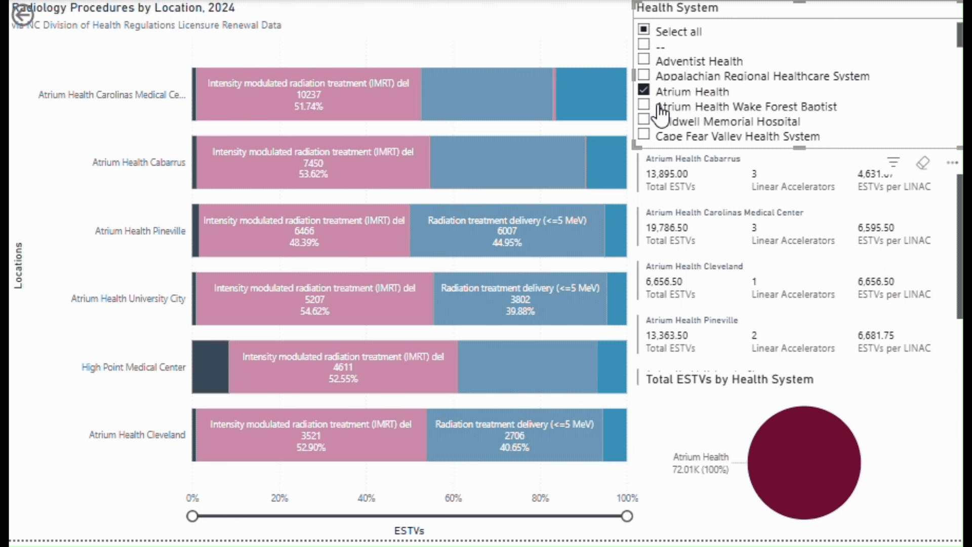
Radiation Utilization at North Carolina Hospitals
While researching cancer policy, I looked into utilization data from the North Carolina Division of Health Service Regulation to identify available radiation services and trends in radiation treatment. I visualized types of treatment by facility, adjusted number of treatments and linear accelerators (radiation machines) per facility, and number of treatments per health system in Power BI. The visualization can be filtered by health system.
In general, the proportion of radiation treatments performed by each health system aligns with the proportion of cancer patients they serve in the state. i.e. Novant Health treats about 20% of new cancer cases in North Carolina and had about 20% of unadjusted radiation treatments (17% adjusted) in 2024. For many facilities, the most common procedure was intensity-modulated radiation therapy, which has overutilization concerns. However, this visualization does not consider number of patients.
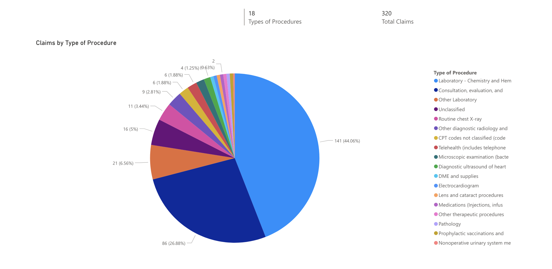
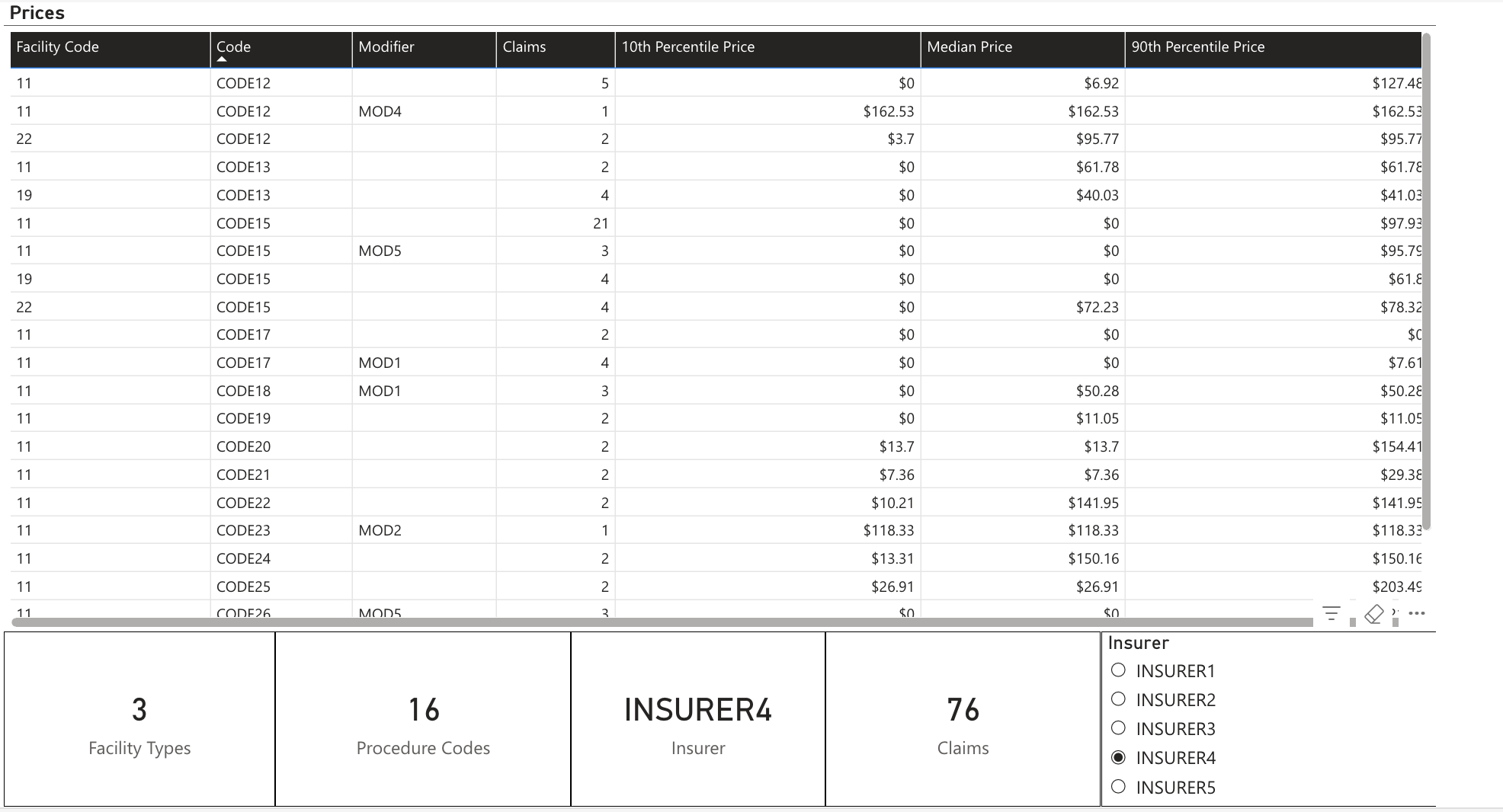
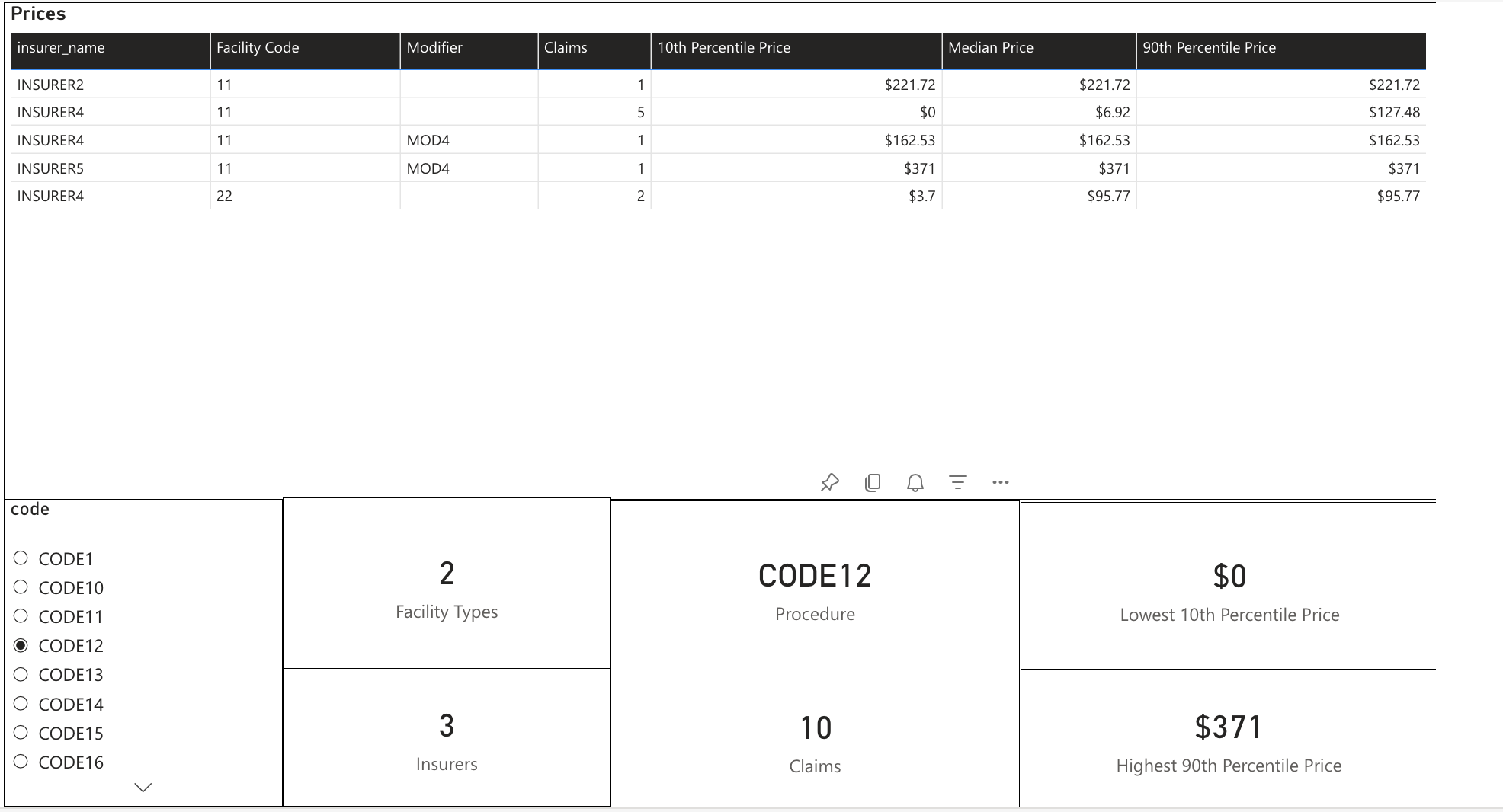
Epic Health Information Analysis
As someone interested in data analysis and healthcare, I wanted to gain more experience with real-world data. I began analyzing Epic Systems EHI Tables exported from patient portals of myself and my family members (with their permission!). Tables were stored in a SQLite database and joined to analyze trends. GitHub repository is available here.
First, I used Python to extract claim remittance information and estimate the 10th, 50th, and 90th percentile prices for each billing code in line with the CMS Hospital Price Transparency rule. I then used the remittance data and the Healthcare Cost and Utilization Project's Clinical Classification Software (a SAS program) to determine what types of services were provided. I then created reports in Power BI.
Transit App
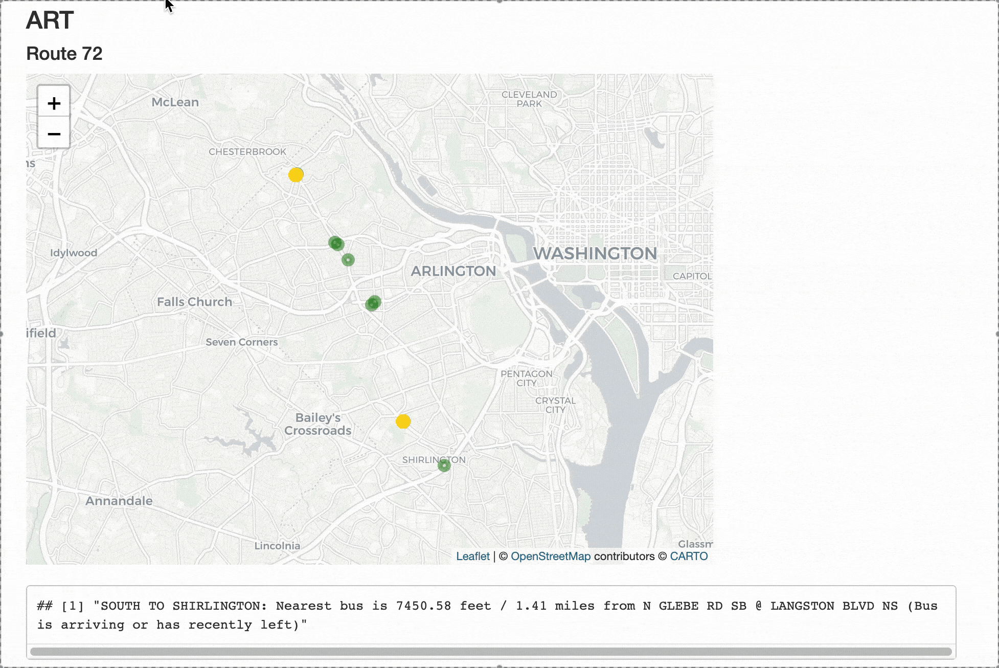
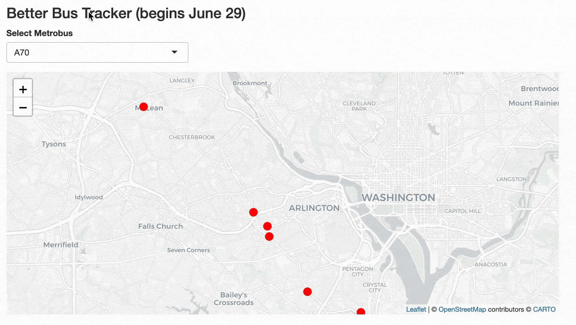
While living in the DC metro, I frequently rode Metrorail, Metrobus, and other regional buses. Since transit around the DMV is operated by different entities, I often had to switch between multiple websites while commuting. Additionally, while WMATA's busETA has a map on desktop, on mobile it only shows a list of stops. ART RealTime similarly does not have a map and only shows distance to a specified stop. In March 2024, I made an R Shiny Markdown app that shows the location of multiple trains and buses I rode frequently using protocol buffers from the WMATA/ART APIs.
The website has maps, calculates great-circle distance between buses and specified stops, and shows current WMATA alerts. I initially hard-coded specific routes and stops, then updated the app to allow the user to select a route. Updating the app also accounted for WMATA's updated bus networks in summer 2025. Mousing over each vehicle shows vehicle number, whether it's in motion, nearest stop, and crowding.
Food Points Spending
In my first year at Duke, I began scraping transaction data from my student account to analyze patterns in how I spent my food points (Duke's dining dollars). By senior spring, I had enough data to write a narrative for the Duke Chronicle on how my spending habits changed over the years. I created Flourish visuals to accompany the story. One of the interactive visualizations is featured below.
This project received an honorable mention in the Multimedia Feature Story of the Year category in the 2023 Associated Collegiate Press Pacemaker Awards.
Time for Duke classes to reach 100% enrollment
Inspired by the Daily Bruin's "How quickly do classes fill up?", I created a Python tool to scrape class information from Duke's student information system, DukeHub, periodically for about an hour each day during registration. (I later learned that Duke has an API for class offerings already.) For best results, view the dashboard on Tableau Public on a desktop computer.

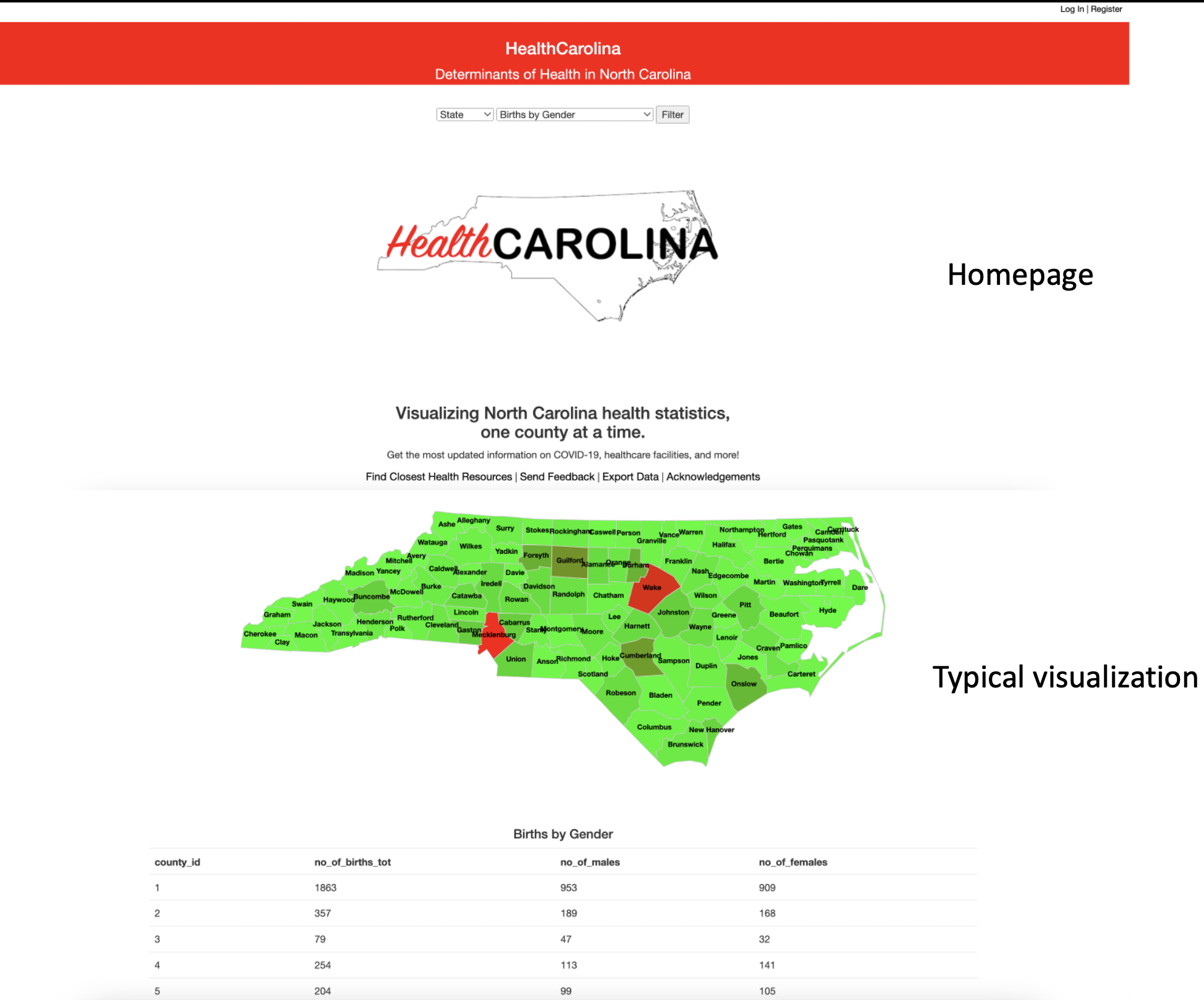
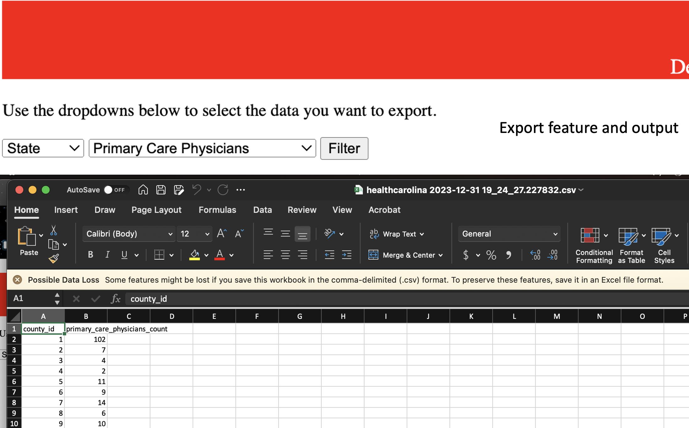
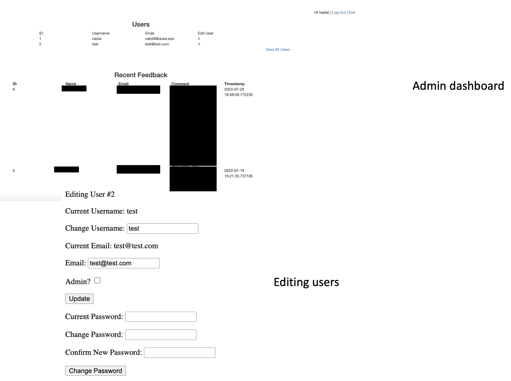
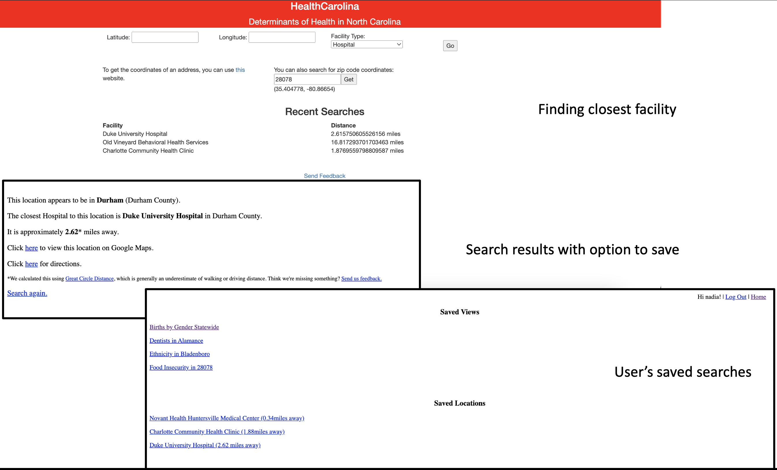
HealthCarolina
Over the course of the fall 2021 semester, I developed a website to display North Carolina health statistics at the county level for my Database Systems class. In addition to generating visuals, the website could also calculate the nearest health facility available in the database. After the course ended, I updated the website to make it more user-friendly, with the option to create an account, save search results and make changes via an admin dashboard.
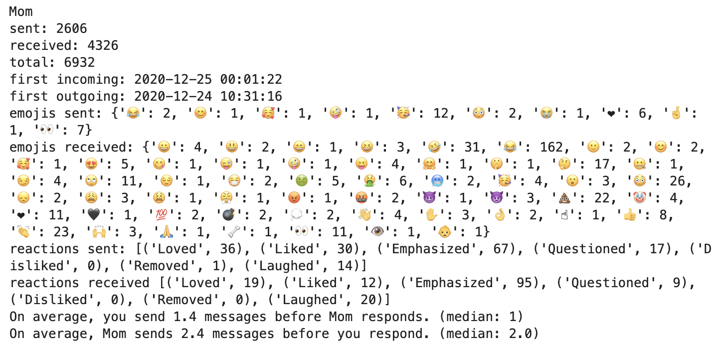
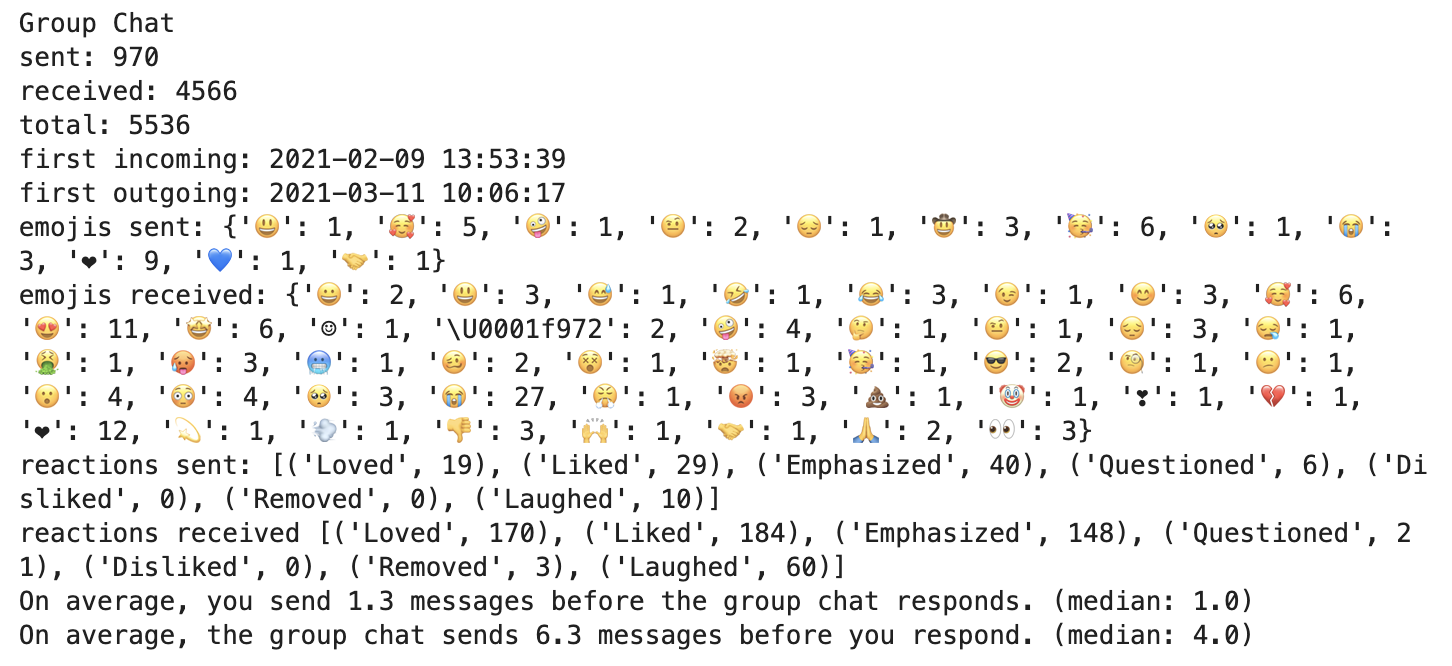
Text Message Analysis
I wrote a Python script to analyze my text messages, which were stored in a db file on my Macbook. The script calculates how many messages I exchanged with a particular contact, which emojis and reactions I used most frequently, and how often I "double texted" before getting a response and vice versa. The analysis shown in the below images includes messages between December 24, 2020 and December 30, 2021.
Qualtrics Survey Collection and Analysis
Skills: Survey Design, Communication, Excel, Python, R, Tableau
Duke Class Registration Temporal Data
Skills: Python (Selenium, Multiprocessing, SQLite3), SQL, Tableau
Building an interactive graphic for teacher salaries
Skills: HTML, CSS, JavaScript, Git Versioning, Databases